The objective of this project was to analyze the existence of any irrigated crop prior to 1997 in order to demonstrate, before the corresponding Public Administration, the right to an irrigation concession.

Used data:
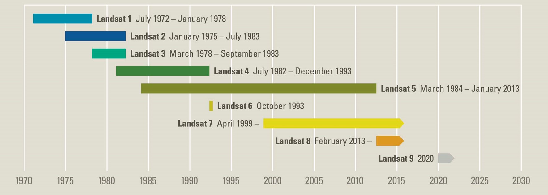
o Satellite: Landsat.
o Resolution: 30 m/píxel
o Bands: VIS, NIR y SWIR
o Years: 1990 a 1997.
o Period: late spring and summer.
Brief description:
To carry out the work, the Landsat images were first analyzed for the presence of any evidence of irrigation presence in the plots indicated by the customer, between the late spring and summer of the years 90 to 97, and the dates on which the highest probability of irrigation was observed were chosen.
To select the images, it was taken into account that they should be close to the end of spring, since this is the time when a cereal crop should have at least one support irrigation to remain green once the possible winter rains have ceased and the water reserve in the soil has been reduced, so the climatology of each year was also taken into account to determine if there were late rains that could condition the results.
From the downloaded images of the selected dates, several vegetation indices were calculated and statistics were generated for each of the indicated plots to determine the degree of probability of the presence of at least one supporting irrigation.
 (No hay votos todavía)
![]() Loading...
Loading...


Leave A Comment