Projects TYC GIS® | Agricultural survey with satellite, orthophoto and drone imagery
Remote sensing images (obtained through satellites, planes or drones) can be of great interest for the execution of certain agricultural [...]
Remote sensing images (obtained through satellites, planes or drones) can be of great interest for the execution of certain agricultural [...]
At TYC GIS we have worked the last months in a agroforestry CO2 […]
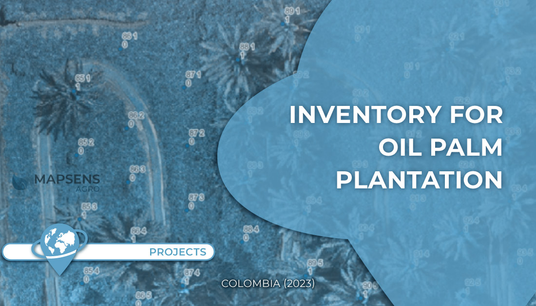
● Location: Meta department (Colombia) ● Surface area: 3000 hectares ● Data source: Drone ● Main objective: Identify living palms [...]
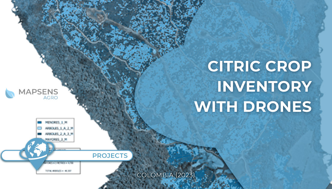
● Property: La Venta ● Location: Valle del Cauca department (Colombia) ● Surface area: 231 hectares ● Data source: Drone [...]
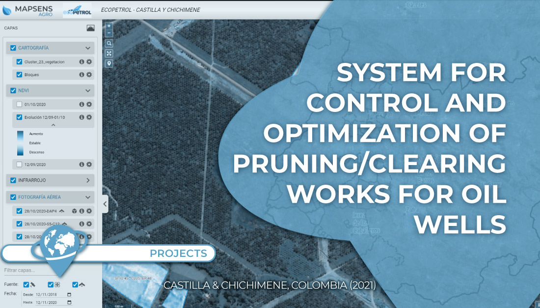
In this project TYC GIS worked on the development of a system to control and optimize the pruning/clearing of 135 [...]