In this project TYC GIS worked on the development of a web application for the analysis of health resources and their response capacity in the region under the European cross-border cooperation program POCTEFA.
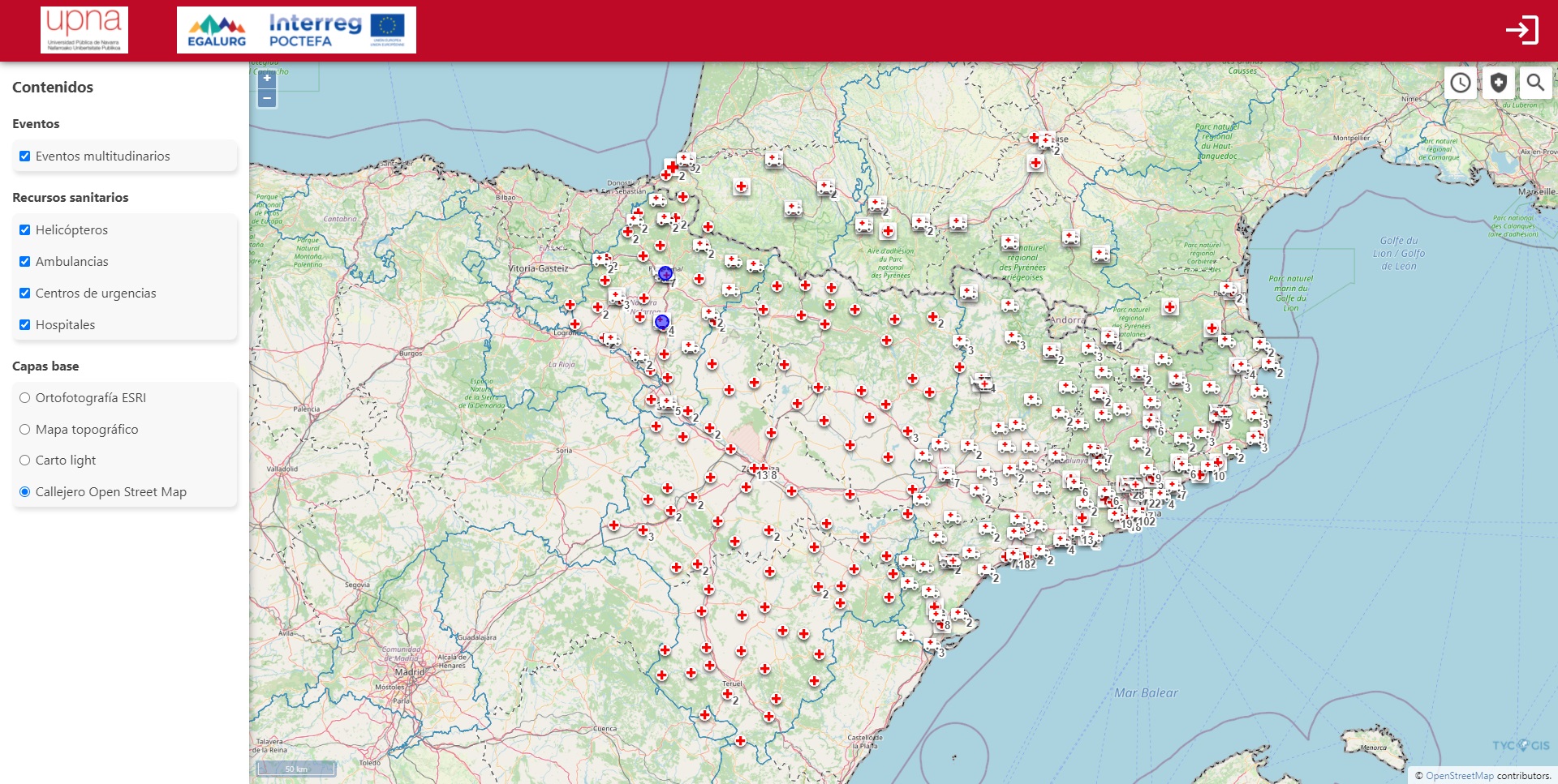
The application consists of several tools to analyze the health resources of the region. It has a series of standard base layers, as well as vector business layers (events and health resources provided by the project partners).
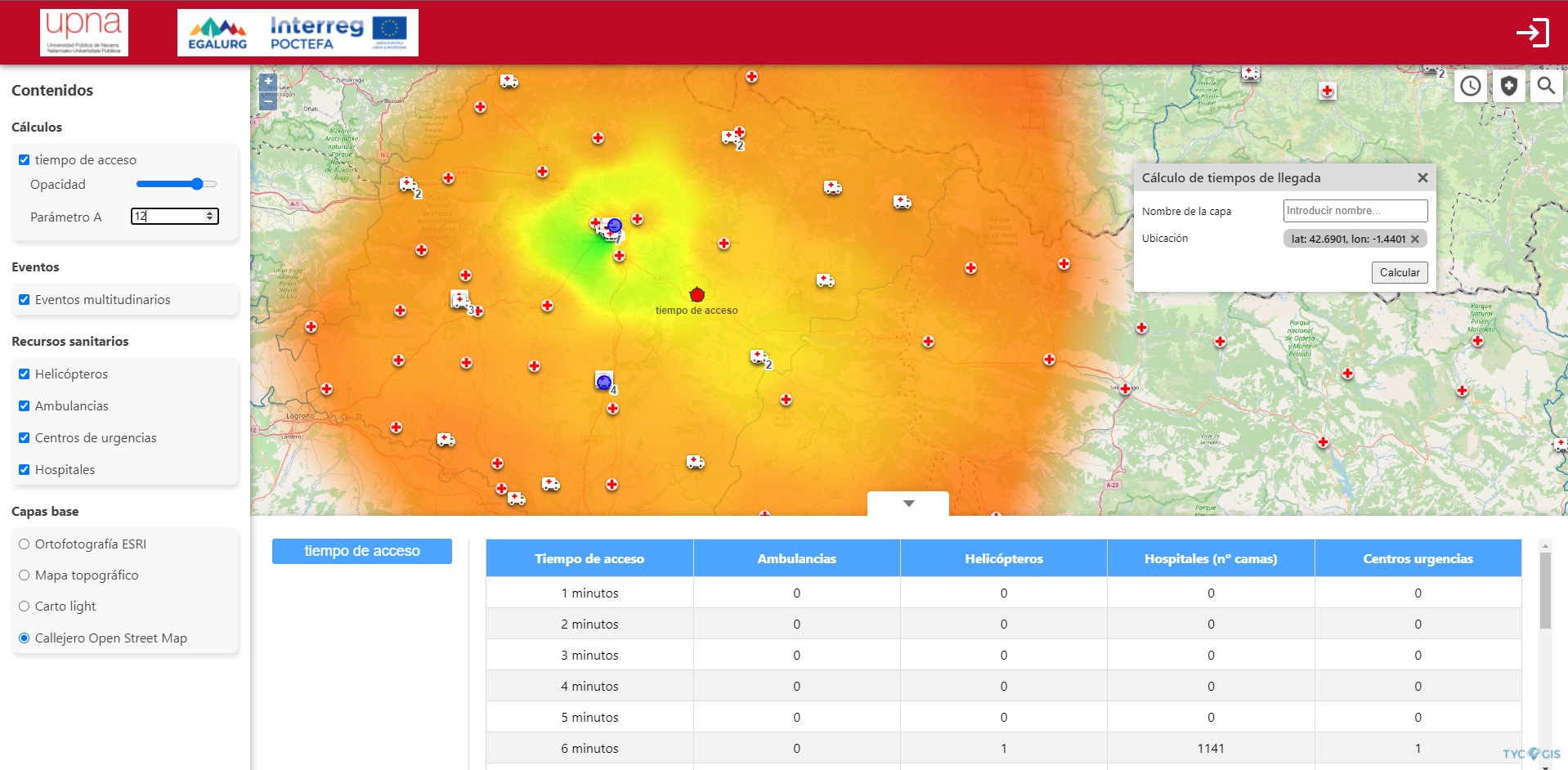
By calculating transit times through the road network, the application calculates the evacuation times for an emergency at an arbitrary point and displays them on a map (IDW interpolation), allowing the response capacity of the emergency system to be evaluated.
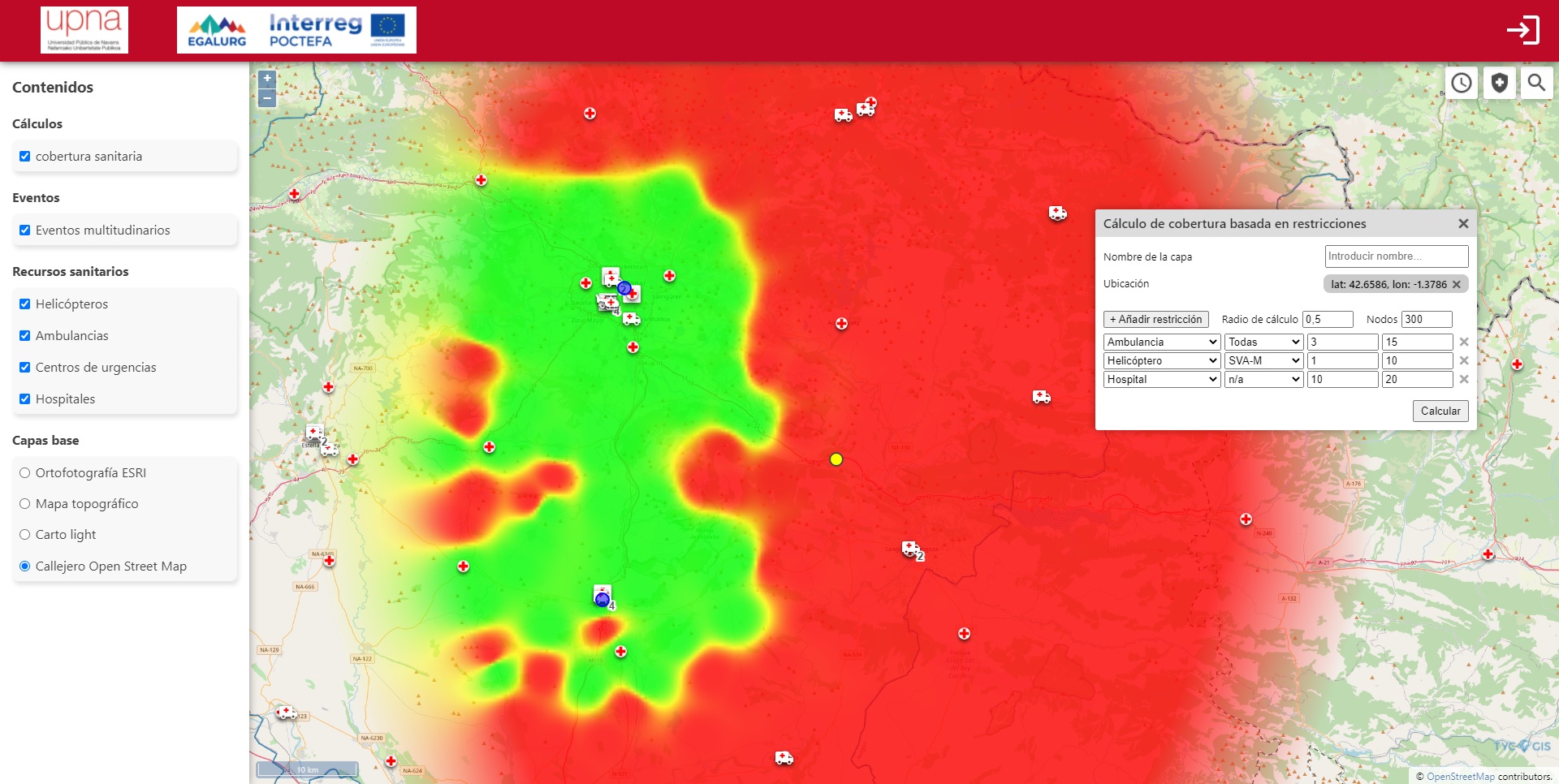
It also has a tool to visualize the degree of health coverage based on requirements established by the user (number of ambulances, hospital beds, etc.), with a maximum access time to each resource. The areas on the map that meet the requirements are marked in a different color from those that do not, allowing a quick visualization of whether a region has an adequate emergency system in the event of, for example, the celebration of a large event.
The application has an online form under identified access, so that project partners can feed the system with data on events that require health planning.
Customer:


 (1 votos, promedio: 5.00 de 5)
![]() Loading...
Loading...


Leave A Comment