
Municipalities are custodians of a large number and variety of elements that make up the urban inventory.
Trees, hedges, benches, fountains,… it is very useful to have a geographic database where we can store these elements and their location.
Unfortunately, the management of a database of this style, operating directly on it, is quite cumbersome. To facilitate the task of adding, deleting and querying elements to the geographic database, it is particularly useful to have software that allows us to interact with the database in an intuitive way, viewing the elements in their geographic location.
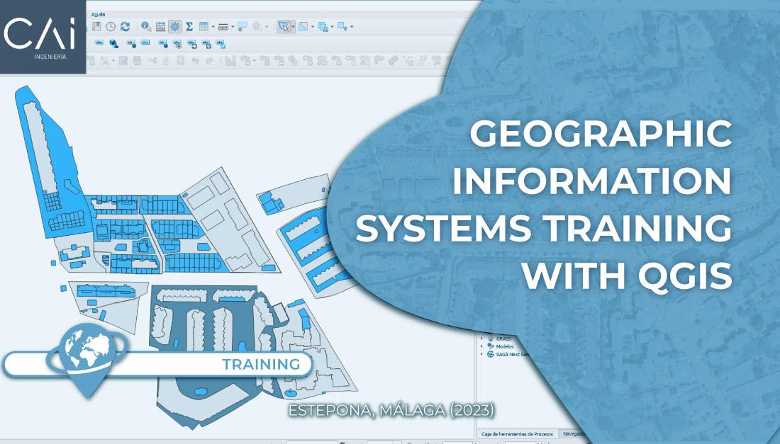
Doing it with a map service would be very laborious and would make it very difficult to have a variety of geographic tools to work with the different layers in which the different elements are structured. Using, on the other hand, a plugin within a GIS software such as QGIS makes it easier to use all the vast collection of tools that this software makes available to us and, in addition, facilitates the development of the required application.
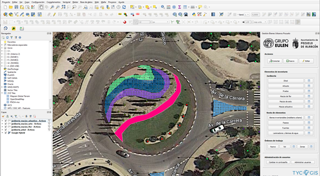
To meet the customer’s needs in the management of the urban inventory of the city council of Pozuelo de Alarcón, a Postgres/PostGIS geographic database was designed and for its management a QGIS Plugin was created that allows to load the elements as layers and apply filters making queries on the database interactively by means of forms, without the need to have knowledge of SQL language.
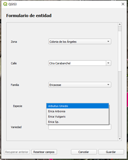
The plugin allows the loading of landscaping layers such as Trees, Shrubs, and Flowerbeds and other types of elements such as Fountains, water features, urban furniture, etc. Each one with its appropriate typology, just as a tree will be a point, a lawn area will be a polygon.
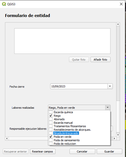
In addition to adding, deleting or modifying features of the elements, the plugin allows you to assign work orders to different elements. For example, we can set a date to paint a bench, assign an operator, include before and after photos of the action and send an email to the desired addresses when the work order is opened and when it is completed. In addition to assigning work orders to elements, we can also assign them to an entire area or create them without assigning them to any type of geographic entity.
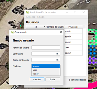
Another feature of the plugin is that it allows the management of users with different levels of access from the plugin itself. Creating new users that can be administrators (full control), users (no control over users) or visitors (viewing permissions), deleting them or changing their level of access to the database.
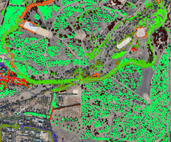
In addition to the plugin, a first massive data load was performed for the tree layer with about 40,000 elements.
Customer:

 (2 votos, promedio: 5.00 de 5)
![]() Loading...
Loading...


Leave A Comment